Bristol Airport (BRS)
City Orientation and Maps
(Bristol, England)
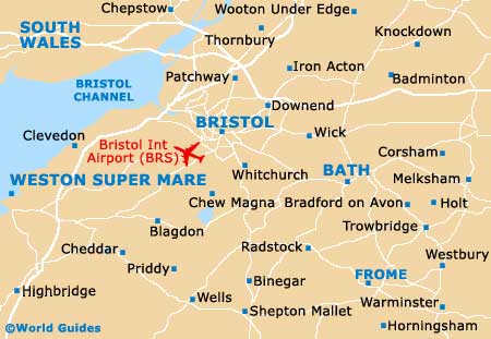
The city of Bristol lies in the county of North Somerset, in the south-western region of England. Bristol is close to a number of important towns and cities, including Trowbridge, Bath and Keynsham to the south-west, Chippenham and Kingswood to the east, and Stoke Gifford directly north.
Also close to Bristol, Clevedon can be found directly west and stands alongside the Bristol Channel (Mouth of the Severn), with the famous coastal resort of Weston-Super-Mare to the southwest of the city, just a few miles from Bristol International Airport (BRS), Yatton and Banwell.
Bristol International Airport (BRS) Maps: Important City Districts
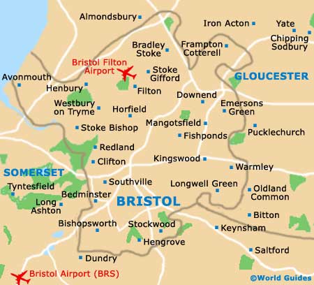
The heart of the city is located to the north of the River Avon and is fairly easy to walk around, although some areas do feature steep hills. Central Bristol is based around the Corn Exchange and the markets, particularly along Broad Street. Here you will find a number of historic landmarks and buildings, with the main shopping area around Broadmead being located nearby.
The suburb of Clifton is sited to the north-west of Bristol city centre and is most famous for its suspension bridge, which dates back to the mid-19th century. Bristol Zoo is also located in the Clifton area and has become a major family attraction, although parking can be difficult on the busiest days.
The harbourside area of Bristol is particularly lively and close to the centre and the city docks. With many waterfront restaurants, bars and clubs, other nearby attractions include the Hippodrome Theatre, the At Bristol complex and the Watershed.
England Map

Bristol County Map
Bristol Map